Tourism of Azerbaijan WESTERN ROUTE
WESTERN ROUTE: BAKU - HAJIGABUL - KURDAMIR - MINGACHEVIR - YEVLAH - TARTAR - NAFTALAN - GANJA - GOYGOL - DASHKASAN - SHAMKIR - GADABAY - TOVUZ - AG
HACIQABUL
 Hajigabul district of HAJIGABUL DISTRICT occupies a part of the fertile ancient Mugan land in the Kur-Araz lowland. The climate is semi-desert, dry and hot, with mild winters. HAJIGABUL LAKE, which was formed as a result of the natural withdrawal of the Caspian Sea in a certain geological period , is in the territory of this region. As a result of the flooding of the Kura River in the spring, the water area of the lake expanded. Now the treated hot water of the Ali Baryamli State District Power Plant (DRES) also enters the lake. This lake, which does not exceed 5 meters deep, does not freeze in winter. It is of great importance as a wintering ground for migratory birds and a suitable place for wetland birds to build their nests. Many of these birds are rare and endangered.
Carpet weaving has been widely developed here since ancient times. The Shirvan school's tradition of weaving hand-made carpets called "Yellow Carpet" still continues.
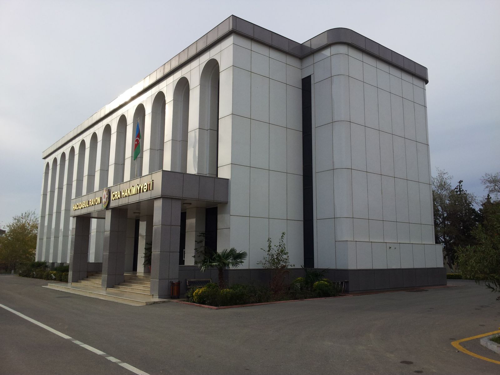
The administrative center of the region is HAJIGABUL, 113 km from Baku. His name means "May God accept your pilgrimage." The pilgrimage of Muslims to the holy cities of Mecca and Medina is called "Hajj". A person who performs Hajj is given the honorary rank of "Haji" and this word is added to the beginning of his name. In essence, Hajj is a complex of spiritual concepts and includes requests for God's mercy and various penances. Therefore, it is known from the name of the city of Hajigabul that it was a camp site not only for trade caravans, but also for pilgrims. Sometimes pilgrims went in caravans, and some pilgrims promised to go on pilgrimage on foot. Here are both pilgrims,
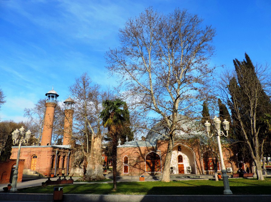
In the 17th century, Shah Abbas built a large caravanserai near Lake Hajigabul, and during the reign of the Safavid dynasty, a city was built, which was then called Mahmudabad. Later, this name was forgotten and the city was renamed Hajigabul. However, the area was still inhabited 5,000 years ago - archaeologists have found the remains of cyclopean structures on Mount Harami in the northwest of the city. The petroglyphs on the walls of these buildings attract attention. Images of people and unusual, fantastic animals were also found on the stones near it. Scientists believe that this object was formed in the Eneolithic period. Other historical and architectural monuments remain near Hajigabul. An ancient minaret mosque, fortress walls, caravanserai, Pir Huseyn khanagah in Baloglan village of Guba residential buildings (XIII-XIV centuries), the mausoleum of Sheikh Hussein, who lived in the XI century (this mausoleum was built in honor of the Sheikh two centuries after his death), as well as the ancient bridge (XVII-XIX centuries). The lion (colored) tile on the khanagah is rightly considered one of the best tiles in the entire Muslim East. At present, some of these tiles are kept in the State Hermitage in St. Petersburg and the Museum of Literature named after Nizami Ganjavi in Baku. In the village of Udulu, the Gungormez defense tower of the early Middle Ages has survived. The name of the tower shows that the people who were defended there were determined not to make concessions to the enemy until their last breath. as well as the ancient bridge (XVII-XIX centuries). The lion (colored) tile on the khanagah is rightly considered one of the best tiles in the entire Muslim East. At present, some of these tiles are kept in the State Hermitage in St. Petersburg and the Museum of Literature named after Nizami Ganjavi in Baku. In the village of Udulu, the Gungormez defense tower of the early Middle Ages has survived. The name of the tower shows that the people who were defended there were determined not to make concessions to the enemy until their last breath. as well as the ancient bridge (XVII-XIX centuries). The lion (colored) tile on the khanagah is rightly considered one of the best tiles in the entire Muslim East. At present, some of these tiles are kept in the State Hermitage in St. Petersburg and the Museum of Literature named after Nizami Ganjavi in Baku. In the village of Udulu, the Gungormez defense tower of the early Middle Ages has survived. The name of the tower shows that the people who were defended there were determined not to make concessions to the enemy until their last breath.
KURDEMIR
The center of the region is Kurdamir city. KURDAMIR DISTRICT is located in Shirvan, a historical province of Azerbaijan, northwest of Baku. This fertile, beautiful land is very attractive for tourism and recreation. Sometimes it is called Gulustan.
Summer is hot and dry in Kurdamir. The climate is considered to be a desert climate. The fauna of the region is colorful - wild boar, wolf, fox, jackal, pheasant, turaj, wild duck and goose live here. The vineyards of this region are very popular. The most popular grape variety is called "Shirvanshahli". Kurdamir region is also known for its carpet weaving traditions. The most popular type of local carpets on the world market is the Shilyan carpet. This carpet is woven in the village of the same name near Kurdamir.
The administrative center of Kurdamir region is KURDAMIR CITY, located on the left bank of the Kura River, 189 km from BAKU.
YEVLAX
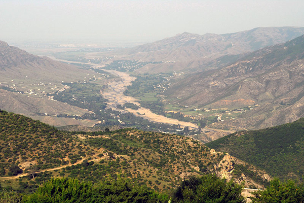
The center of the region is the city of Yevlakh. Yevlakh region is located on the right bank of the Kura River and is one of the largest cities in the region, popularly called GANJABASAR (so called because it is the territory of the former Ganja khanate). Ganjabasar region covers several regions of Azerbaijan. What unites these regions is their common history and similar geographical and climatic conditions.
YEVLAX CITY, the administrative center of Yevlakh region, is located 280 km from Baku. Yevlakh is located at the crossroads of many roads. From here there are direct roads to Mingachevir, Sheki, Balakan, Ganja and Khankendi. It is no coincidence that in the written sources of the XII century Yevlakh was called "the gate of Karabakh". Both caravans and travelers passed through these "gates" and took their flocks to the summer pastures in the alpine meadows. A number of archeological objects belonging to the Bronze Age and early Middle Ages were discovered in Garamammadli, Garanmanli and Khaldan villages of Yevlakh.
Mingachevir
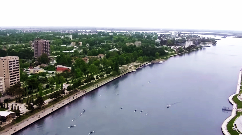 Mingachevir, one of the youngest cities in Azerbaijan, was founded in 1945. Today, this prosperous city, located on the picturesque banks of the Kura River, is of great interest not only in terms of the main center of Azerbaijan's energy sector (65% of all electricity produced in the country is not here), but also in terms of tourism development.
Mingachevir is also known as a sports center. A number of athletes from around the world often come to the famous Kura Olympic Sports Training Center to train.
Despite the fact that the modern city of Mingachevir was established in connection with the construction of the Mingachevir hydroelectric power station, people have lived in the surrounding fertile lands for many years and settled in the coastal areas.
Two settlements and 4 large cemeteries discovered in the south of the Bozdag range and on the banks of the Kura are considered to be the largest archeological complex in the South Caucasus. During the excavations, about 20,000 samples of material cultural heritage belonging to the III-II centuries BC were found. The exposition of the city's History Museum is based on many themes.
During archeological excavations, glassware, gold and silver, jewelry, coins, a number of items belonging to the ancient eastern cities show the high level of development of trade and cultural ties in Mingachevir. During the Middle Ages, this city was celebrated as the center of jewelry stores, shops and baths. During the Soviet era, there was a boarding house here, where many tourists from all over the country rested during the season.
Today, many beaches are crowded. Here you can stay in "Kur Hotel", "Agsaray Deluxe Hotel & SPA", "River Side Hotel".
TARTAR
The center of the region is the city of Tartar.
The fertile land of Karabakh is one of the oldest regions of Azerbaijan. The famous Karabakh khanate, once the center of Shusha, is located here. This land has many historical and architectural monuments, rich fauna and flora. The Karabakh carpet, one of the most colorful types of Azerbaijani carpets, was created here, and the famous breed of Karabakh racehorses was bred here. Numerous talented poets, writers and musicians have endowed the land of Azerbaijan with such a rich natural environment. The most famous singers - mugam singers (mugam - is the national music genre of Azerbaijan) came from Karabakh. Mugam melodies form the basis of Azerbaijan's national opera. Unfortunately, today Karabakh is occupied by Armenians.
TARTAR DISTRICT It is located in the lower reaches of the Tartar River, bordered on the north by the Injachay River, where temperatures do not fall below two degrees Celsius in winter and rarely exceed 25 degrees Celsius in summer. The climate in the region is different - in some areas there is a temperate climate, and in some places a semi-desert climate. Due to such a changing climate, sheep breeding is widely developed here. Khachinchay also passes through this region. In the past, this area was part of the Albanian state, one of the earliest state institutions of Azerbaijan (Manna, Media, Atropaten, Caucasian Albania). Like other Azerbaijanis, Albanians practiced Zoroastrianism in ancient times, and later converted to Christianity.
TARTAR CITY is the administrative center of Tartar region. The city is located on both banks of the Tartar River, 332 km from Baku. Along with animal husbandry and agriculture, they are also engaged in carpet weaving, weaving and embroidery, which are ancient folk arts. Located on the ancient caravan route, the city of Tartar was once called Chaparkhana. There are a number of architectural objects in Tartar, Kangarli, Garadagli, Qaynaq, Azad Garagoyunlu villages of the region.
NAFTALAN
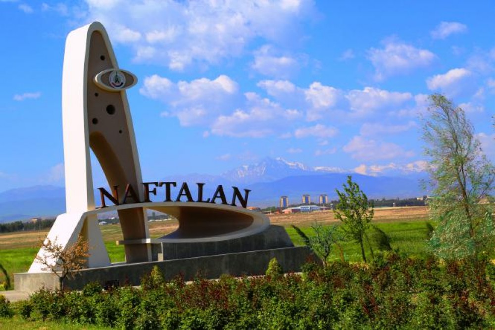 The population of the small town of NAFTALAN, located near the center of Goranboy, Goranboy, is 6,500. Patients visiting sanatoriums and boarding houses in this resort town are treated with Naftalan oil and ointments based on it. Naphthalene oil is a very effective tool for the treatment of wounds, skin, nerve, urological and gynecological diseases, as well as the liver, joints and soft tissues around the joints, musculoskeletal system. The city of Naftalan was built on the site of a small village of the same name. The word "naphtha", which forms the basis of this name, means "flowing, filtering" in the language of Media, one of the oldest state institutions in the territory of Azerbaijan.
In Azerbaijan, several thousand years ago, they were able to use naphthalene along with oil for various purposes. It was not only the locals who used Naftalan oil to treat wounds, but also the soldiers of Alexander the Great, Roman legionnaires and Vikings who invaded Azerbaijan, as well as Alans, Khazars and other tribes used Naftalan oil to treat wounds. Naftalan was also an export product. It was transported by caravan routes to other countries - Kievan Rus, Central Asia, Afghanistan, India, the Persian Gulf. The famous medieval traveler Marco Polo described Naphthalan oil as a "magic ointment for skin diseases."
When the oil industry in Baku began to develop rapidly in the 19th century, the number of engineers, industrialists and bankers from Europe in Azerbaijan increased significantly. In 1874, the German engineer Jager was interested in what the locals said about naphthalene oil and regulated the production of naphthalene oil in Germany. He exported the ointment to various countries around the world. It is clear that the Germans, who produced ointments based on Azerbaijani Naftalan, were good managers, because this ointment was not used only in European countries. During the Russo-Japanese War of 1904, Japanese soldiers' pharmacy kits included jars containing naphthalene ointment. This ointment was used as a first aid kit. It was written on those jars: "Whoever has this ointment in his hand, let him not be afraid of any creator."
Visitors can stay at Chinar Hotel & Spa, Naftalan Health Center, Gashalti Sanatorium, Miracle Naftalan Sanatorium, Magic Naftalan Sanatorium and others.
GANJA
 GANJA CITY - Located in the Ganja-Gazakh lowland on the banks of the Ganjachay River. The river city is divided into two parts. It is a kind of border between two climate zones - temperate-hot semi-desert and arid steppe climate, as well as temperate warm climate zone. The city has a population of 302,000 and is 375 km from Baku.
Ganja is the second largest city in Azerbaijan. There are Ganja State University, the Academy of Agriculture, the Ganja Branch of the Azerbaijan National Academy of Sciences, the Scientific Research Cotton Institute, and the Experimental Agricultural Station. A modern Olympic Sports Complex has been built in the city.
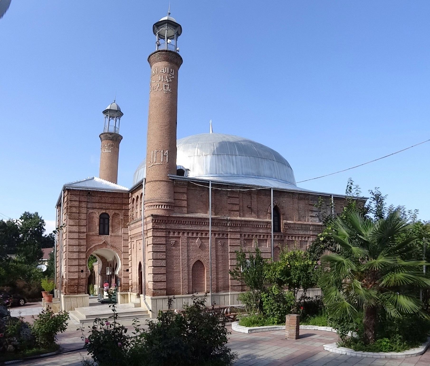
Ganja is the homeland of world-famous poet Nizami Ganjavi, poetess Mahsati Khanum and Mirza Shafi Vazeh. There are many historical monuments here: JUMA MOSQUE and its madrasa, Sheikh Ibrahim's tomb, GIZIL HAJILI, OZAN, BALA BAGHBANLI, SHARAFKHANLI and SHAHSEVAN mosques, Ganjachay gorge built over the river DOMED IMAMZADE, there are extremely beautiful ancient city baths (baths are working now). Visitors are advised to visit the Nizami Ganjavi Mausoleum at the entrance to the city.
Ganja is one of the oldest cities that played an important role in the history of our country at different times.
The Arabs called this city Canza. During the excavations in Ganja, archaeologists discovered ancient human settlements dating back to the 2nd century BC, and many archeological objects belonging to the Bronze Age around Ganja.
The history of Ganja is the history of its almost destruction by the invaders and its subsequent progress. In the Caspian-Arab wars, foreign warriors, Alan tribes, Mongols, Georgian 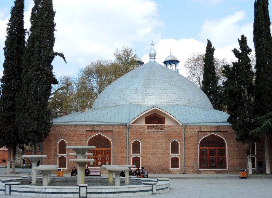 princes, Ottomans destroyed Ganja. After the destruction of the residence of the Christian leader of the Albanians in Barda in the 11th century, his residence was moved to Ganja. People of Christian and Islamic faiths coexisted peacefully in Ganja, and goods from Eastern countries to the Black Sea coast were transported by caravan routes passing through this city.
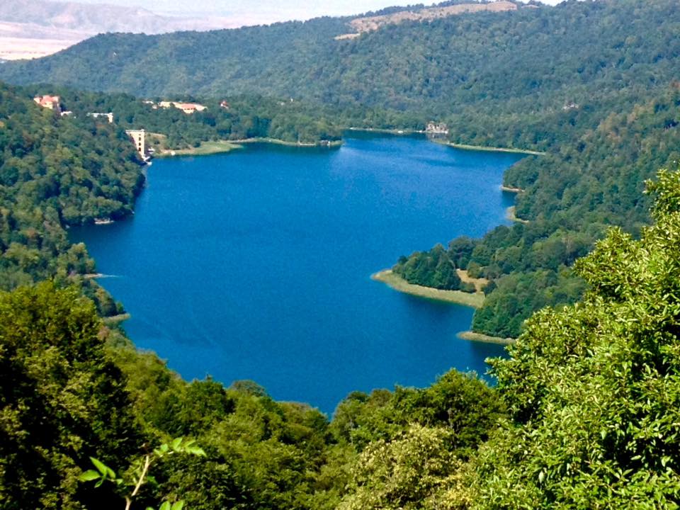
In the 12th century, Ganja was the capital and residence of feudal lords. However, during the same period, the city was twice hit by a very strong earthquake. As a result of an earthquake in 1139, Ganja was devastated, and about 250,000 people died. One of the peaks of Kapaz Mountain flew and crossed the Agsu River, thus creating Goygol.
In the 17th century, the city was rebuilt 6 km east of its original location. At the beginning of the 18th century, Ganja was again attacked by invaders, and in the middle of that century it became the center of the Ganja khanate. The Ganja khanate existed until it was occupied by Russia. When the superior forces of the Russian army attacked Ganja in 1804, Javadkhan's detachment defended Ganja heroically, and Javadkhan himself died bravely. After this event, in 1804, Ganja was renamed Yelizavetpol in honor of Empress Elizabeth of Russia.
In 1918, during the collapse of the Russian Empire, Ganja became the capital of the independent Republic of Azerbaijan for several months.
 At that time, an officer school was opened in Ganja. In 1935, Ganja was renamed Kirovabad. Only in 1989, on the eve of Azerbaijan's re-independence and the collapse of the USSR, the historical name of Ganja was returned to it.
At present, the HAJIKAND resort area is located near Ganja. There are many tourist routes, boarding houses, tourist bases and holiday homes.
GOYGOL State Reserve is the first reserve in Azerbaijan. Established in 1925 to protect and study the ecological systems of the middle mountainous, forested and partly subalpine zones of the Lesser Caucasus, as well as Goygol, Maralgol, Zeligol and other mountain lakes, the reserve consists of forests and mountain meadows.
Goygol, located in the northern foothills of Murovdag, a little south of Ganja, at an altitude of 1566 m above sea level, is rightly considered the pearl of Azerbaijani lakes. This reserve, the first in the Caucasus, consists of two parts - the main part and a branch called "ELDAR PINE FOREST". The distance between the two parts of the reserve is 80-85 km.
Ganja has its own local history museum. Among the exhibits of the museum there are many interesting finds from the Bronze Age. There is a Drama Theater and a Children's Puppet Theater in Ganja.
Tourists and guests of the city can stay in the Ganja Hotel, Ramada Plaza Gence, Vego Hotel, Deluxe Hotel and Caravanserai hotels located in the city center.
GOYGOL
The center of the region is Goygol city.
GOYGOL DISTRICT It is located in the foothills of the Lesser Caucasus Mountains, a little south of Ganja. Agriculture is well developed in this region, which attracts attention with its extreme scenery. The climate is 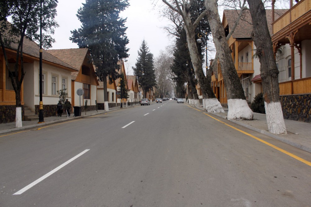 temperate. There are especially many bird nests here. The Ganjachay and Gushgara rivers are excellent places for hunting and fishing. The highest point of the region is the Murovdag range, located at an altitude of 3724 m above sea level. This region is very popular among tourists and ecotourists. When they come here, they stay in the houses of local residents and in the surrounding villages.
The administrative center of Goygol region is GOYGOL CITY, located 384 km from Baku.
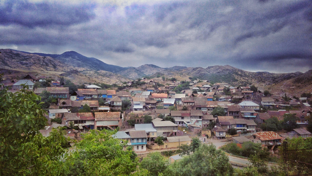
The city of Goygol was built in the 19th century on the site of an ancient village called Khaniglar by displaced Germans. They planned the city with their own care and in 1819 renamed it Yeleniyendorf. Even now, when you look at the smooth streets of this city, the facades of the houses built of wood, carved on it, the church (Lutheran church), you remember that the Germans once lived here. During Stalin's rule in the USSR, local Germans were deported to Central Asia.
Goygol has a local history museum, music school, cinema, numerous cafes and restaurants. Tourists coming to this quiet, green city go on tourist routes from there by various routes. Archaeological finds from the Bronze and Iron Ages confirm that the city has an ancient history. Historical and architectural monuments such as the LUTERAN CHURCH (1854) and two bridges over the Ganjachay - "TWO-EYED BRIDGE" (XVI century) and "THREE-EYED BRIDGE" (1896) have survived in Goygol. Examples of surviving monuments near Goygol include the 12th-century fortress in ZURNABAD village, the 16th-century mausoleum in SARI GAYA village, the 12th-century "WHITE BRIDGE" in TOPALHASANLI village, as well as a number of historical monuments in Chaykend village.
DASHKASAN
 The center of the region is Dashkesan city. DASHKASAN DISTRICT is the center of ore mining in Azerbaijan and is located in the north-eastern foothills of the Lesser Caucasus. Here the temperature can change very sharply. Thus, up to 20 degrees below zero in winter (in general, this is not typical for Azerbaijan), and up to 35 degrees in summer, as in Absheron, located in the semi-desert zone. The fresh air of the region, mountain pastures and springs, rich in alpine meadows, attract both tourists and vacationers.
Archaeologists have discovered the remains of ancient human settlements of the Stone Age in the territories of Khoshbulag, Zagali, Gurbulag, Amirvar, Bayan, Dardarya villages of this region. Two ancient stone bridges over the Gushgara River and the mausoleum in the village of Ahmadli are historical and architectural monuments that have survived to the present day. The monastery built in 487 in Gushchu village has survived. In the village of Bayan you can see the ruins of a Christian temple dating back to the XV century.
The administrative center of the district is DASHKASAN CITY. As can be seen from the name of this city, located 397 km from Baku, this region has been famous for its stone and wood carving masters since ancient times. At present, carpet weaving and hosiery weaving are well developed here.
In small restaurants, customers are offered typical dishes of the national cuisine, and in kebab shops it is possible to taste delicious national dishes made of fresh meat, as well as listen to folk music performed by ashugs (improvisational folk singers). Dashkasan honey is considered one of the best types of honey in the country. Residents of the nearby city of Ganja like to come to Khoshbulag village of Dashkesan region to rest.
SHAMKIR
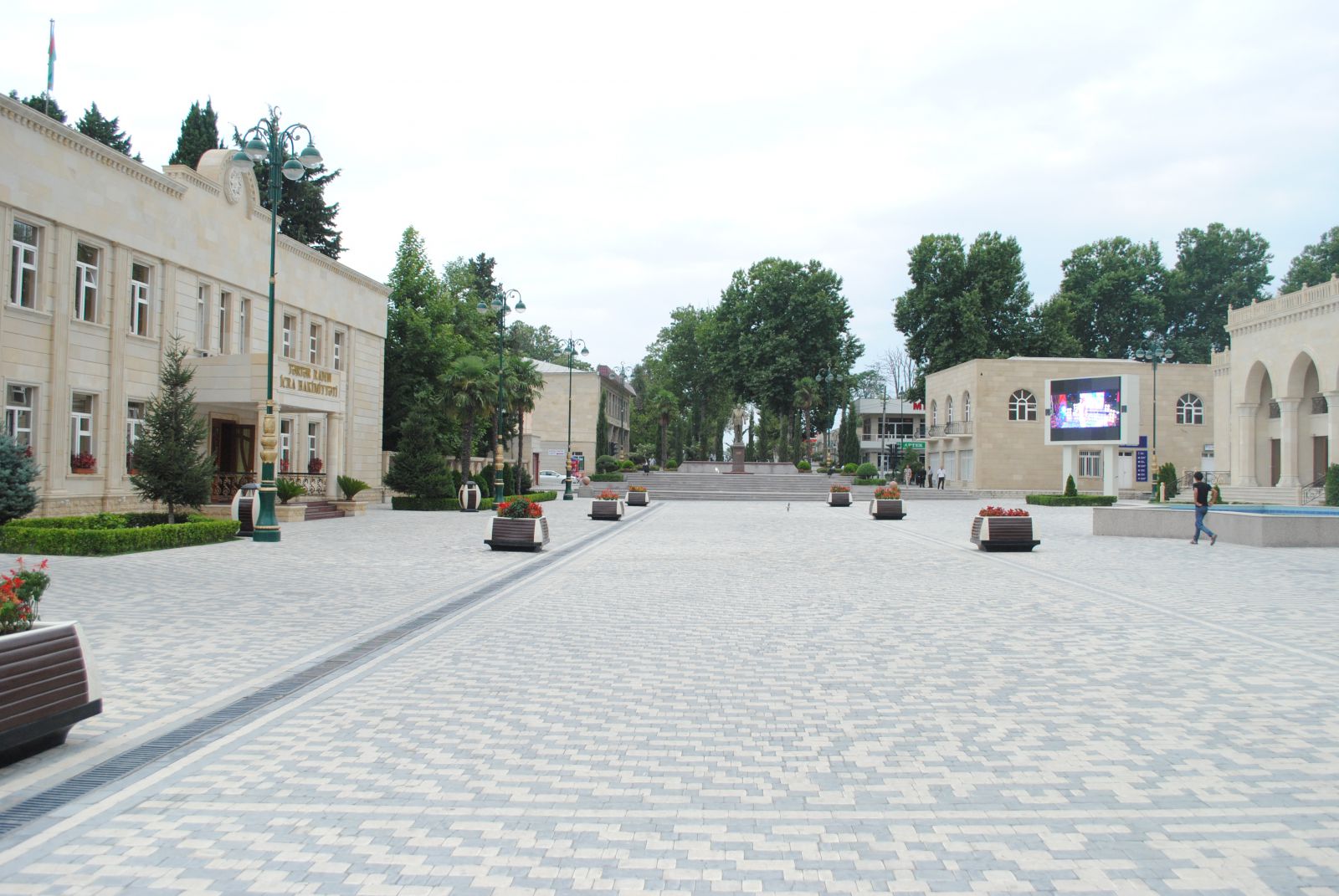
The center of the region is Shamkir city.
There are many archeological objects belonging to the Bronze Age and Early Iron Age in SHAMKIR DISTRICT. They were mainly found in the villages of Chanlibel, Seyidler and Garajaamirli.  There are a number of historical and architectural monuments of the Middle Ages : fortresses in the villages of TATARLI and ASHAGI SEYFALLI, bridges built in the village of TAHNALI and over the river ZAYAM, YUKHARI CHAYKEND, GUNASHLI, MOUNTAIN MOUNTAINS can be in the villages of CAJIRLI.
There are also places that are popular with fishing enthusiasts - the YENIKEND dam on the Kura River is more popular.
The administrative center of the region is Shamkir, an hour's ride from Ganja. The distance of Shamkir from Baku is 417 km.
In the 19th century, there was a small colony of German immigrants called Annenfeld. As a reminder of the inhabitants of this colony, as well as of the khans, there are several streets and a Lutheran church left in an ideal smooth condition.
According to written sources and archeological information, this city was built in the V-VI centuries on the bank of the GREAT SHAMKIR river near the present MUKHTARIYAT village, 20 km away from modern Shamkir.
In the Middle Ages, there was an 8-tower feudal castle in that city called Shamkur. Shamkur's wealth attracted not only merchants but also invaders. Like many ancient cities of Azerbaijan, Shamkur was repeatedly destroyed during its existence, then rebuilt and a period of progress has passed. However, after one of the next attacks, the survivors of the city moved out and built a new city.
Around modern Shamkir, two ancient fortresses of the 17th century have survived - Shamkhor Fortress and Koroglu Fortress (the name of this fortress was chosen as our national symbol in honor of the brave Koroglu, who fought heroically against oppressors and cruelty). Most scholars are of the opinion that Koroglu was a real historical figure. However, it has not been convincingly established that he actually lived in the Chanlibel fortress.
You can stay at the Excelsior Hotel Shamkir in Shamkir or rent a private house.
GADABAY
The center of the region is Gadabay city.
 GADABAY DISTRICT is located in the Lesser Caucasus Mountains, including high mountains (the height of Goshabulag peak is 3549 meters, the height of Gojadag peak is 3317 meters) and medium-altitude mountains. The difference in altitude above sea level makes the climate different. The tundra climate in the mountainous area gradually shifts to a dry climate with hot summers. The distance of the district center from Baku is 462 km.
You can go to Gadabay either from Shamkir or from Tovuz's Govlar station. Although the Tovuz road is more picturesque, it is difficult for cars to cross it: it needs "pedestrian" cars.
There are good conditions for fishing in the Shamkir River in the Gadabay region. There is a special fishing farm near GALAKAND village. The flora and fauna of Gadabay region is rich and diverse. "KIZILAGAG" reserve is located in this region. There are also several natural objects included in the list of objects protected by the state, such as "Natural Monuments of Azerbaijan" - Shamlig, Reed, Godekdere, Govdu forests. KECI-KECHI, CUYUR, AYI, JARGA springs, as well as NARZAN, KIZILCA, MORMOR, CHALDASH mineral water springs are of this type.
Ancient cultural monuments included in the history of Azerbaijan under the name of KHOJALI-GADABAY CULTURE are cyclopean structures of the Bronze Age, as well as "GADABAY TREASURES" - ancient pottery for housekeeping and stone storage, 16th century Shah Tahmasib found. This money was in circulation in a wide area from Tabriz (now Iran) to Shirvan and Ganja.
Examples of historical and architectural structures that have survived in the region are the TAGLI BRIDGE (XIX century), the Tower in the village of Gala (XVI century), the Maiden's Tower in the village of Soyudlu (or Namard Castle - 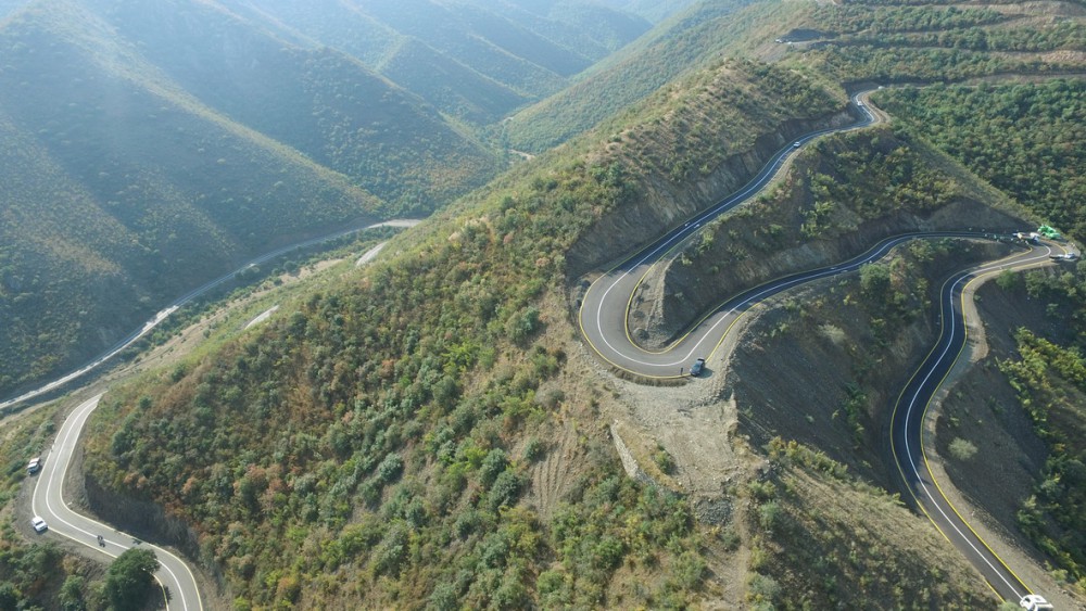 IX century), NOVOSARATOVKA, CENTURY, KÖYÜLÜ Christian temples of the period can be shown.
In the village of SARATOVKA live representatives of an old tribe of Russians called "dukhobor". They have preserved their material and spiritual culture.
Among the folk arts in this region, wood carving, carpet weaving, weaving socks and gloves from colorful coarse wool yarn, and processing sheepskins are well developed.
The territory of Azerbaijan has been in the spotlight of some well-known entrepreneurs in the west. For example, the NOBEL BROTHERS became rich at the expense of Baku oil. The German company SIMENS built two Egyptian factories in Gadabay in the late 19th century. A quarter of all copper smelted in Tsarist Russia was produced in these plants. The Siemens brothers took a keen interest in the history of this unusual land and organized archeological excavations in the region. Based on the results of these researches, a scientific work called "GALAKAND" was written.
Visitors can stay in a hotel in the city center.
TOVUZ
 The center of the region is Tovuz city.
TOVUZ DISTRICT of Azerbaijan is located in the west of the republic, bordering Georgia and Armenia. The Kura, Akhinja, Tovuz, Zayam and other rivers flow through this region. There are many forests, springs, rich flora and fauna (wolf, fox, rabbit, turaj, partridge) on the mountain slopes. The climate is arid, where mainly rabbits and waterfowl can be hunted.
Ancient monuments have been preserved in Tovuz region. The most interesting of them are the 12th century temple in KIRZAN village, the 17th century mosque in YANIGLI village, the mausoleums in GAZGULU village, the castle in ALIBAYLI village and others. There are also numerous archeological sites from the Bronze, Iron and Early Middle Ages.
The administrative center of the region - TOVUZ CITY is located 457 km from Baku.
Like most cities in Azerbaijan, Tovuz was built on the site of ancient Stone Age and Bronze Age human settlements. It is as if this city has left its mark on the genetic memory of the people to remind them of the places where our ancestors lived for thousands of years. According to ancient Turkish written sources, the name of this city is derived from the names of two related Turkic tribes - OGUZS and TOGUZS. This name was established as a toponym because it originated here.
The city of Tovuz, as a modern settlement, was founded by German immigrants, who named it Traubenfeld.
There is a small museum of the famous ashug Huseyn Bozalganli (1860-1942) in Tovuz. Ashig Huseyn Bozalganli knew the Koroglu saga by heart from beginning to end.
Tourists can stay in the homes of local residents or at the Ayan Palace Hotel.
AGSTAFA
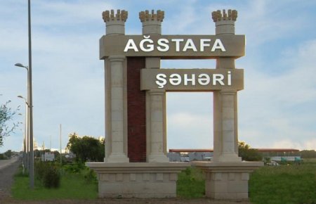
The center of the region is the city of Agstafa.
AGSTAFA DISTRICT is located in the foothills of the Greater Caucasus Mountains, on the border of Azerbaijan with Georgia and Armenia. The climate of the region is temperate. The locals are mainly engaged in animal husbandry and agriculture .
Several small rivers and the Agstafachay, a tributary of the Kura River, flow through the region. CANDARGOL Lake is also located here. In the village of TATLI, located 20 km from the city of Agstafa, the spring called GALACHMA is a favorite vacation spot of both locals and tourists. Customers love the kebab cooked here.
GARAYAZI State Reserve, located on an area of 4,900 hectares on the banks of the Kura River, was established in 1978 to protect and restore the tugai forests in the Kura area, the Garayazi lowland and the middle reaches of the Kura River. The main object protected in the reserve is a mass of tugai forests.
The "GARAYAZI-AGSTAFA" reserve, established in 1923 on an area of 12,000 hectares, is also located in the Agstafa region. The purpose of the reserve was to preserve Caucasian deer, pheasants, pheasants and other rare species of animals and birds and to increase their numbers. The reserve is located in the area of tugai forests in the middle reaches of the Kura River, on the border of Georgia and Azerbaijan. The flora and fauna of this reserve are identical to the flora and fauna of the "GARAYAZI" reserve, which is directly adjacent to it.
A number of historical monuments have been discovered in the territory of the region: an ancient human settlement called MOLLA NAGI HILL of Paleolithic period near KOCHASGAR village; 17th century TOWER and 19th century MOSQUE in KIRAG KASAMAN village; Mosques of the 19th century in the villages of KOLKHALVALI, GARAHASANLI, DAGKESAMAN and DUZ QISHLAG, etc. There are countless monuments of the Stone Age, Bronze Age and Iron Age in this area. These facts show that in ancient times the level of settlement in this region was quite high. There is a need for a detailed study of all these archeological sites and new excavations.
Above the city of Agstafa, near the shepherd's beds in the Keshikchidag range (where sheep graze in the summer), there are defensive fortresses and cave-type monasteries built in early Christian Caucasian Albania. During the USSR, this zone was closed for traffic, because the military units of the Transcaucasian Military District were located there. For this reason, this unique complex has not been properly studied. There was no traffic, and most of the ancient paintings in the caves were destroyed by artillery fire. This complex belonging to the Caucasian Albania, which was one of the state institutions of ancient Azerbaijan, is currently being studied by archaeologists of the National Academy of Sciences of the republic.
The city of AGSTAFA is located near the Georgian border, 479 km from Baku. The city was built in 1914 as a railway junction. At that time, this small town was called Elizabeth.
From here you can take a train to the capital of Georgia, Tbilisi. Special attention is paid to the preservation of historical and architectural monuments and cultural heritage of the region - carpet weaving and ashug art in Agstafa. Archaeological finds - cups, vases, household items and ornaments - are kept in the local ethnography museum.
Tourists will stop at Medine Hotel, Nesiboglu Hotel and West Hotel.
QAZAX
 The center of the region is Gazakh city.
GAZAKH DISTRICT is located near the western borders of Azerbaijan. In general, Gazakh and Agstafa regions are considered the western border not only of modern Azerbaijan, but also of the ancient Caucasian state of Albania. The division of this region into two independent administrative districts - Gazakh and Agstafa - took place relatively recently.
There are state-protected historical monuments (architectural and archeological monuments): BROKEN BRIDGE (12th century); DAMCILI cave; Temple of the 5th century in the village of YUKHARI ESKIPARA; 15th century Sugar Fortress temple; megalithic type DIDEVAN fortification; Complex of temples of Albanian period (7th century) in DASH SALAHLI village; Remains of ancient city-type human settlements recently discovered near GOYAZEN Mountain (late Middle Ages), which attract attention with the remains of the castle walls.
There are many ancient settlements in Gazakh region: caves inhabited by Neanderthals (Mustye) on Mount AVEY, between Dash Salahli and Kemerli villages, in the valley of the Incasu River, on the north-eastern slopes of the Lesser Caucasus, near the Damcili cave on Mount Avey, Remains of KHAL-KHAL town and castle walls were found near the beautiful GIZIL KAYAN. It is believed that this area was one of the summer residences of the Albanian rulers. Archaeologists have unearthed numerous fossils of Bronze Age pottery on the surface of the earth without any excavations. The Albanians once routed Roman Rome's troops here. Ancient written sources say: "
Bronze Age burial mounds were discovered in the BARKIN MOUTH gorge, a little to the west of the GOLDEN ROCK. All these historical sites (except for the Broken Bridge) are located near the city of Gazakh. Thanks to the efforts of the enterprising people of this region, many archeological artifacts have been collected and exhibited in the local Museum of Ethnography. Visitors to the village of Yukhari Salahli can visit the house of the famous Azerbaijani poet Samad Vurghun.
The relief of Gazakh region - mountains, valleys, rivers (Kura, Agstafachay, Jogaz, Khramchay) has always been suitable for seasonal livestock. Local shepherds 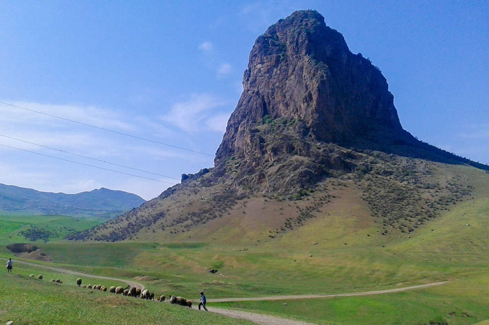 bring their flocks from pastures (mountain pastures) here in winter. The local character of folk music and national cuisine stems from the natural conditions of this area. There are a lot of ashugs here, they are invited to various family celebrations and holidays.
It is believed that the ancient names of the city of Gazakh were "Kasal" and "Gazaka". According to some written sources, in the 8th century, the commander Marwan ibn Muhammad built a city here.
Gazakh, the last major city on the western border of Azerbaijan, is home to talented poets and writers. Among the people, Kazakhs are known as people with a special poetic feeling. A number of famous ashugs, scholars and commanders were born here. Poets Samad Vurgun, Molla Panah Vagif, writers Mehdi Hussein, Ismail Shikhli, General Aliaga Shikhlinsky, who participated in the defense of the fortress of Prot-Arthur, known as the "God of Artillery", and others are originally from Kazakhstan. In 1917, the first teachers' seminary in Azerbaijan was opened here - in Gazakh.
The city has museums, an ancient mosque and other interesting objects depicting the life of famous poets originally from Gazakh VAGIF and VIDADI. Gazakh is also known as one of the oldest carpet centers and equestrian factories. Local horses of the DILIBOZ breed bred here are especially popular. "Dag Kasaman", "Gazakhcha", "Aghgoyunlu", "Dord Buynuz", "Damgali", "Shikhli", "Chobankara", "Borchali", "Fakhrali", "Kaymagli" carpets, which are the products of Gazakh carpet school, are big in the world market. there is a demand. The cuisine of the Gazakh zone consists mainly of simple but very tasty meat and flour dishes. Tourists are advised to stay in the homes of local residents.


কোন মন্তব্য নেই:
একটি মন্তব্য পোস্ট করুন