SOUTH ROUTE:
BAKU - SALYAN - BILASUVAR - JALILABAD - MASALLI - LANKARAN - LERIK - ASTARA
SALYAN
 SALYAN DISTRICT is located in the south-east of Azerbaijan, in the LANKARAN-ASTARA region, which has been inhabited since ancient times, with its unique cultural and historical traditions, unique flora, long-lived inhabitants, and a unique cuisine dominated by fish dishes .
In a sense, the Salyan region is the gateway to this region - the transport arteries of the republic, highways and railways connecting Azerbaijan with its southern regions, as well as the Middle East are located in this area.
In ancient times, different tribes settled here, in the course of history, they replaced each other and became one of the components of the ethnogenesis of the Azerbaijani people. One of these tribes was called "sal". The city of Salyan also got its name from this word.
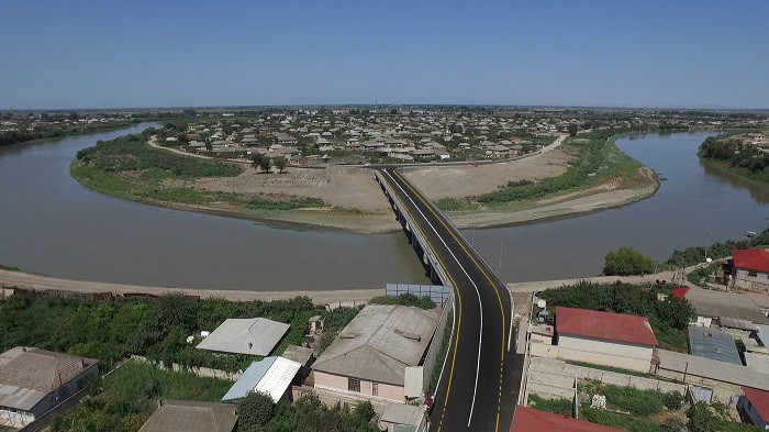
One of the main rivers of the republic - KUR river flows through the territory of Salyan region. The eastern part of the region joins the shores of the Caspian Sea. Its proximity to the sea and the river has determined the characteristics of the national cuisine of the inhabitants of this area.
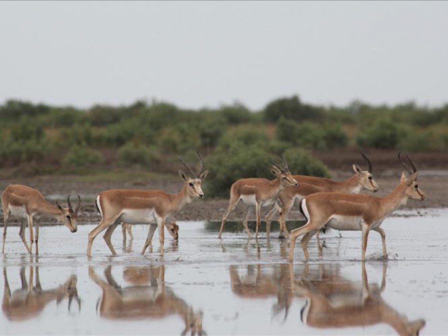
"SHIRVAN" NATIONAL STATE PARK is located here (in 2003, the reserve of the same name was reorganized and turned into a national park). The reserve itself was established in 1969 in order to preserve and increase the typical vegetation complex of the Shirvan lowland (an area characterized by semi-desert and wetland ecosystems). The "BANDOVAN" reserve located here was built in 1961. With an area of 30,000 hectares, the reserve covers part of the territory of two administrative districts - Salyan and Garadagh. The reserve was established to protect gazelles and waterfowl and restore their numbers.
 This land is also interesting in terms of archeology and surviving historical and architectural monuments. In the 70s and 80s of the 20th century, a number of objects belonging to the Middle Ages were discovered here.
There are a number of archeological sites in the region, covering the period from the Bronze Age to the early Middle Ages. Among them are the MARIMLI necropolis, the jug tombs necropolis in the village of KURSANGI, and the ruins of ancient human settlements in the present-day villages of NOXUDLU and MAHMUDABAD.
BABAZANAN volcano, one of the many mud volcanoes in Azerbaijan, is located 5 km from the district center. The healing properties of the mud from this volcano still attract locals.
Shortly before reaching Salyan, another mud volcano is visible near the coast in the area called DASHGIL. Dashgil reserve is also located here. It is a suitable place for hunting waterfowl, kutum, carp and other fish species living in the Caspian Sea.
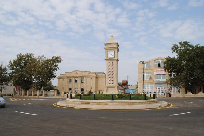
The distance of SALYAN CITY, the administrative center of Salyan region, from Baku is 126 km. The ancient mosque, which dates back to the 19th century, is an architectural monument protected by the state. At present, travelers and tourists can use the services of a modern caravanserai. Here you can taste the dishes of the local ancient Azerbaijani cuisine.
Visitors to the Salyan region can stay at the Kura Hotel in Salyan.
KNOWLEDGE
 BILASUVAR region borders Iran from the west. The climate here is semi-desert and arid desert, with dry summers. The peculiarities of the climatic conditions have created the development of cotton growing, grain growing and cattle breeding here . According to one hypothesis, the name of this region is associated with the search for water - the word "Bilasuvar" means "there is water here." Another version is that the name is associated with people who were able to find water in the desert. According to this version, "Bilasuvar" means a person who knows where the water is.
As in the whole territory of Azerbaijan, the territory of Bilasuvar region has been inhabited since ancient times. This is confirmed by numerous archeological finds and the remains of architectural monuments found in the region. Urban places such as Outer Aghdam, Inner Aghdam, TORAGAYLI belong to the ancient period and the early Middle Ages. Unfortunately, most of these archeological sites have not yet been studied.
BILASUVAR is a small town. It is located 182 km from Baku. Visitors to the city can stay at the Zirve Hotel.
JALILABAD
JALILABAD DISTRICT is located on the border of Kur-Araz lowland. Climate zones here range from temperate hot climates, where rainfall is almost evenly distributed, to semi-desert and arid steppe climates, characterized by summer droughts. The rivers Incechay, Bulgarchay, Misharchay, Goytepechay flow through the territory of this region. The intensive development of viticulture in this region is due to the climate and relief features of the region. The territory of Jalilabad region is an excellent place for hunting. About 14.7 thousand hectares are covered with forests. Waterfowl can be hunted at the "Zavvar" hunting farm. The fauna of the region is represented by wolves, rabbits, badgers, wild boars, foxes, wild ducks, geese, eagles, turkeys and other animals. 
The administrative center of Jalilabad region - JALILABAD CITY is located 208 km from Baku. Archaeologists have unearthed and excavated an ancient city called HAMSHAHRATAPE on the outskirts of the city. As a result of the excavations, objects of material culture belonging to the Eneolithic period were found. According to scholars, during the early Zoroastrian period, one of the Aryan tribes - the famous Magi tribe - lived here. Representatives of the Magi tribe traditionally became priests of this ancient religion and joined the ranks of its supreme priestly caste. They mastered the secrets of medicine and Zoroastrian astrology. These people were so talented that over time, the name of the tribe became a special name and became "Magic".
Numerous mounds, urban sites, human settlements and necropolises were found in the region. The period of their creation covers the period from the Bronze Age to the early Middle Ages.
The city was originally called KHASILI. Later it was renamed ASTRAKHANBAZAR. The current name of the city is named in honor of JALIL MAMMADGULUZADE, the founder and irreplaceable editor-in-chief of "MOLLA NASRADDIN" magazine, the first satirical magazine in the East.
Jalilabad has a small museum of local lore, a park and a hotel.
MASALLI
 MASALLI DISTRICT is located on the main transport artery of this region - on the highway from the Azerbaijani capital to the south, to Iran. One of the borders of the region is the shores of the Caspian Sea and the other is the Talish Mountains. The VILASH, ALVADICHAY and TATYAN rivers flowing through the region flow into the Caspian Sea.
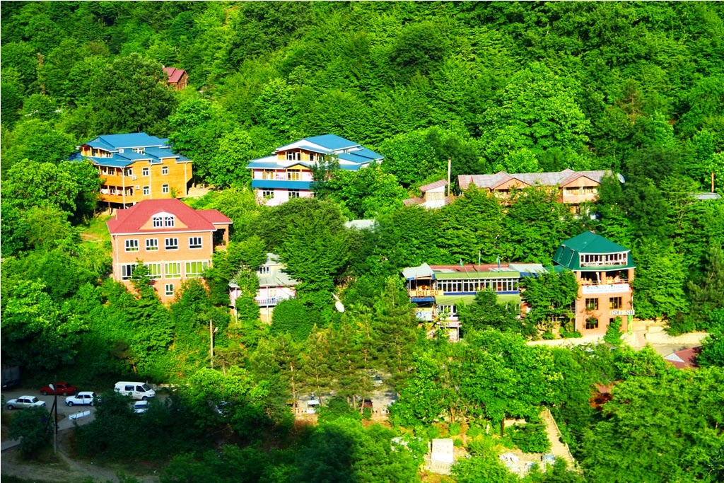
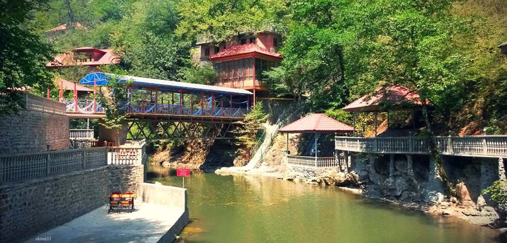
Masalli region is rich in mineral springs. Among them are those with thermal water, and those with cold water like ice. Some springs contain a lot of sulfur and other trace elements. ISTISU mineral spring is located in one of the picturesque mountainous corners of the region. The water of this spring has healing properties. There are those who come here for treatment, as well as those who come to rest. Thermal waterfall and suspension bridge give a special beauty to these places. Istisu, a very popular medicinal mineral water, is packaged and sold in pharmacies across the country.
MASALLI CITY, the administrative center of Masalli district, is located 230 km from Baku. In the past, a tribe called "parable" lived in these places. This name, engraved in the memory of the people, conditioned the modern name of the city. There is a small lake in the forest near Masalli. This is a favorite vacation spot of both locals and visitors to the city.
The existing historical and architectural monuments in the territory of Masalli are represented by a mosque built in the XIX century, an ancient bath, the ARKIVAN tower and the Museum of Ethnography.
Along the road from Masalli to Lankaran, on the south-western shores of the Caspian Sea (GIZILAGACH bay) is located GIZILAGACH reserve. The territory of this reserve covers the entire water area of the bay, as well as nearby land areas. The reserve was established in 1929 to protect and breed wetlands and wild birds, and to protect water and semi-desert natural complexes, where migratory birds spend the winter. Among the 248 species of birds and 54 species of fish living here, there are also species listed in the Red Book.
LANKARAN
 The territory of Lankaran region covers the eastern shores of the Caspian Sea and the whole Lankaran lowland in the part up to the Talish mountains. Many comfortable sandy beaches have been built on the shores of the Caspian Sea. Humid subtropical climate, harsh winters, dry and hot summer days, rainy autumn have conditioned the rich flora and fauna of the region. LANKARANCHAY, VERAPVUL, GUMBASHI, BOLADI rivers flow in spring and autumn mainly due to rainwater, and in summer they calm down and become significantly shallower. Therefore, the Khanbulanchay reservoir was established in this area to irrigate agricultural crops.
Lankaran region is another important agricultural region of Azerbaijan. Its unique climatic conditions have led to the cultivation of subtropical plants here, represented by tea mandarins, dates, feijoa and several types of lemons. The famous tea of Lankaran does not lag behind the classic Indian tea in its quality and aroma.
It is no coincidence that skilled carvers are trained here. After all, this land is rich in unique tree species, including rare and endemic species. The famous ironwood, propka tree, velvet birch tree, hirkan beech, silk acacia, oak, eucalyptus, and broad-leaved oak, which is the main forest tree of the Talish mountains, are a kind of symbol of these forests. In addition, many wild fruit trees, medicinal herbs and shrubs grow in the forests of Lankaran. Therefore, it is not surprising that two reserves and one sanctuary have been established in the Lankaran region.
GIZILAGACH Reserve is located on the southwestern shores of the Caspian Sea in the Gizilagaj Gulf region. The territory of this reserve covers the entire water area of the large Kyzylagach Bay, the northern part of the Small Kyzylagach Bay, as well as the nearby parts of the coastal zone. It was established in 1929 to protect and breed wintering and migratory water, swamp and wild birds. There are 248 species of birds and 54 species of fish.
HIRKAN RESERVE with an area of 21,435 hectares is also located in this region. In 2004, the reserve was transformed into the HIRKAN NATIONAL PARK. The national park 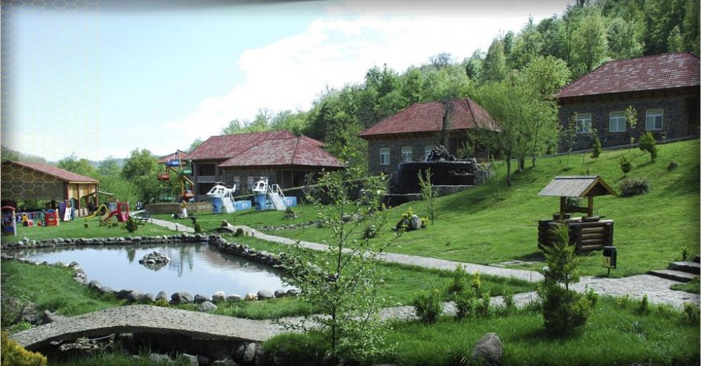 occupies part of the territory of Astara and Lankaran districts . Small Kyzylagach Reserve (area 10.7 thousand hectares) was established in 1978 to protect and restore the number of wintering birds in the Small Kyzylagach Bay, migratory water, swamps and surrounding areas, as well as rare and endangered birds. This reserve is directly adjacent to the Kyzylagach Reserve.
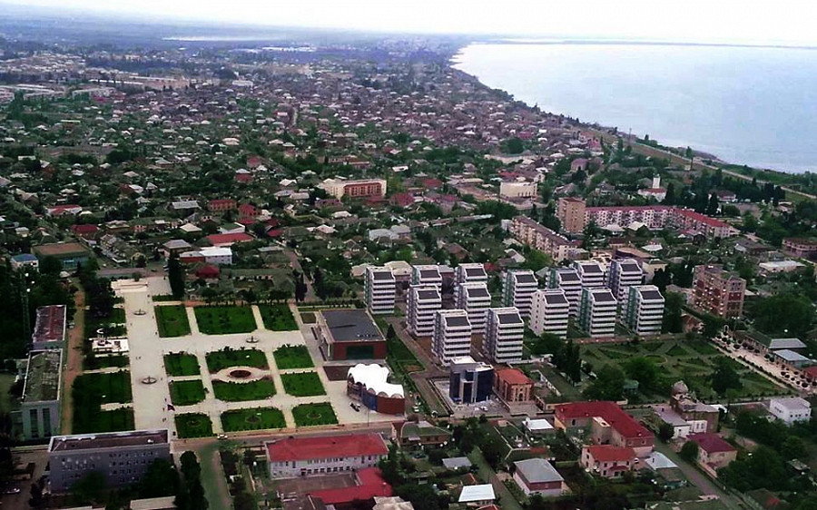
The administrative center of Lankaran region is the city of Lankaran. The distance from Baku is 268 km. The city's favorable geographical location, fertile soil and natural resources have always attracted people here. Lankaran is located in the south-east of the country, on the banks of the Lankaranchay River. It is believed that the city was built here about 300 years ago, near the sea. Initially, a fortress with guard towers was built and a lighthouse was built. The original name of the city was "LANGARKUNAN". The word means anchored stop, ie port.
The only surviving historical architectural monuments in Lankaran are the Khan's House, the Small Fortress Mosque, the Guldesta Minaret and the ancient Haji Mirza Bath, which attract attention with their original facade patterns. If you visit the history museum in the city, you can get acquainted with the history of this land. The museum's own building is also very interesting from an architectural point of view. There are many decorative and applied arts workshops in the city. Those who work there are engaged in the art of carving on wood, stone and metal. The first performance of the theater in Lankaran took place in 1850, and the proceeds from that performance were distributed in full to the local poor. The glorious commander - General Hazi Aslanov was also born and lived in this city. Now a museum exposition has opened in the house where he was born.
There are various high-class hotels and cottages in the city, such as AB QALA, GIZIL TAJ, CAUCAS SEASIDE, XANBULAN, Khan Lankaran Hotel.
LERİK
 Lerik region, one of the most beautiful parts of Azerbaijan, is located in the heart of the Talish Mountains. The beautiful nature of this place, the mountain air, springs, rivers, fertile soil, which smells of the forest, make the inhabitants of this land live a long life.
This land has a very unique history, and this history reflects the most interesting moments in the complex history of all of Azerbaijan. Numerous cultural and historical monuments remain in the territory of Lerik region, proving that this land was inhabited in the Neolithic period. For example, the site of a stone-age cave camp, the ancient settlement of Gizyurdu, located at an altitude of about 2,430 m above sea level near the mountain village of MISTAN.
Baba Hasan Mausoleum near Jonu village, Baba Isa Mausoleum in Mondigah village, Khoja Seyid Mausoleum in Khanagah village (XIV century), Pir Yusif Mausoleum near Kekonu village, Jabir Mausoleum on the road to Jangemiran village (XII-XIV centuries) and Khalifa Zakariya mausoleum The ancient and ordinary old trees in the area of these mausoleums are worshiped. Once upon a time, Alexander Duma visited the village of Jangemiran, and later in one of his works he poetically described the heroic fate of one of the women living in this village.
The original mosque built in the 19th century in Lulekaran village has survived. The preservation of stone ram figures in a number of villages of the region is also noteworthy.
As mentioned above, Lerik region is known as a land of longevity. For example, a resident of this region SHIRALI MUSLUMOV (1812-1975) led an active lifestyle for 163 years, 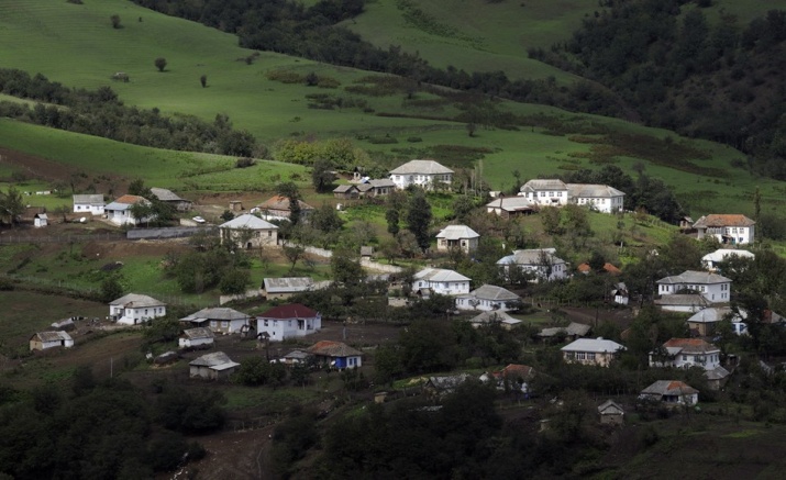 setting a world record for longevity . Another resident of the region MAHMUD EYVAZOV (1808-1958) lived for 150 years. Dozens of residents of Lerik still live a century ago, but have not lost their ability to work.
Among the types of folk art in the region, carpet weaving, making various household items from wood, as well as the art of pottery are more developed. A special feature of carpet weaving here is that these carpets are woven not on traditional vertical looms, but on horizontal looms directly on the floor.
The administrative center of the district is the city of Lerik. The city of Lerik, 325 km from Baku, is located at the foot of the Talish Mountains, in a fertile plain. Here it is possible to visit the museum of local lore, to look at the memorial erected in memory of the victims of the Karabakh conflict.
In Lerik, you can stay in the apartments of local residents, as well as in popular recreation areas such as "Relax Hotel and Resort", "Shelale" and "Meshachi".
ASTARA
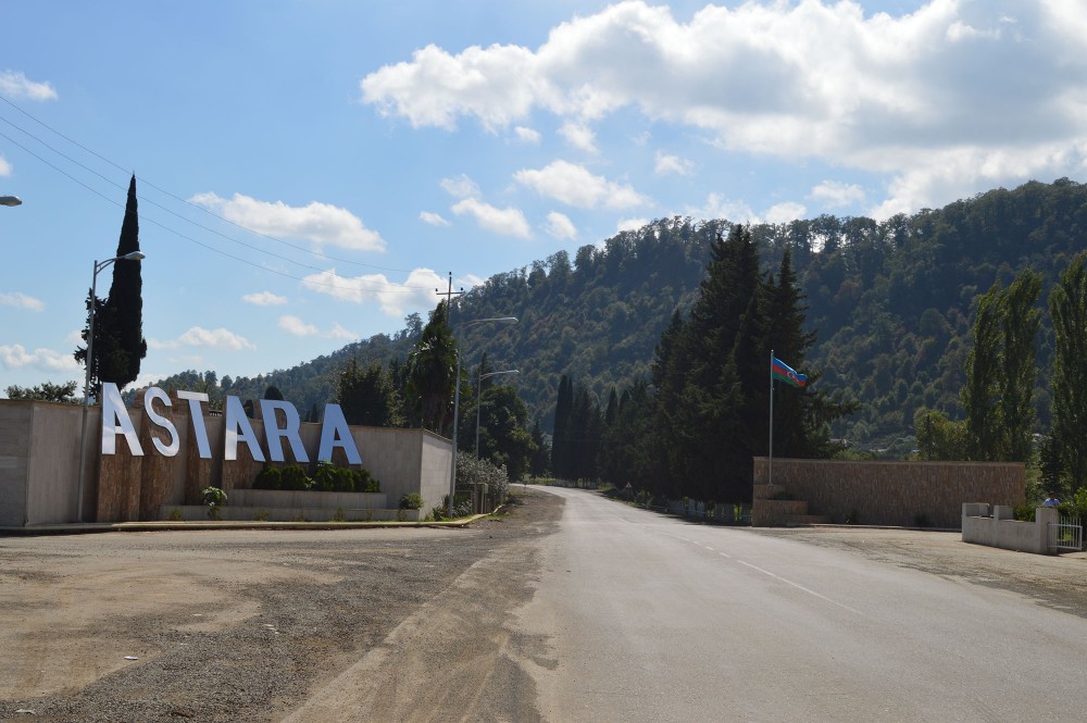 Astara region is located in the south-east of Azerbaijan on the border with Iran. Part of the territory of the region is occupied by the Talish Mountains and the rest by the lowlands. The peculiar climatic conditions of this region are connected with it.
The area of forests is 37,000 hectares. Taking its source from the tops of the Talish Mountains, the Astarachay and Tangerud rivers flow into the Caspian Sea. The flora of Astara is rich and colorful. Wild quince, mulberry, hawthorn, blackberry, silk acacia, evergreen conifers, as well as representatives of the linan family grow here. Because it is so heavy, the famous iron tree that looks at the water also grows here. From time immemorial, locals have used this wood to make looms, and in modern times to make certain details for looms used in the textile industry.
The flora and fauna of the region are also colorful. Roe deer, wolves, wild cats, deer and other wild animals live freely in the forests of Astara. On the shores of the Caspian Sea, many clean, clear beaches have been built.
Part of Hirkan National Park is located in this area. This fact attracts fans of eco-tourism to Astara. There are many healing mineral springs in the area called Istisu near the Iranian border. Tea and vegetable growing are widely developed in this region. Citrus plants are grown.
There are numerous (about 400) historical and architectural monuments in the region. In almost every village, traces of human existence can be found in this land since ancient times. For example, 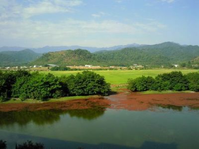 there is a tower in the village of Shindan. It is popularly called Babek Fortress. The tower in the village of Nudis, the Mashadi Abutalib bath in the village of Pensar, the Haji Teymur mosque and the Haji Jahanbakhish mosque, the mausoleum in the village of Shahagaj, and the bath of Hamid Abdulla of Karbala in the village of Archivan are among them. There is a famous sulfur spring in that village. When you bring a burnt match to the water of this spring, the water ignites. Remains of a castle in the village of Gapichi Mahalla, a 7th-century mausoleum, a caravanserai, stone statues of the Stone Age and Bronze Age, and the remains of 13th-century bridges in the villages of Sinyapert, Lomin and Pileken remain.
The administrative center of Astara region is Astara, 322 km from Baku. Astara, an important transit point on the Baku-Tehran highway, is a small border town bordered by the sea on one side and the Talysh Mountains on the other. Rice fields around the city attract attention. Fishing is also widespread here - no event has changed the characteristics of the local national cuisine.
The exposition of the museum of local lore in Astara is quite rich. In addition to ancient coins minted at different times and confirming the formation of trade in the region in ancient times, the museum also houses a stone statue of a man. This statue is more than 2000 years old.
Visitors can stay in the apartments of local residents or at the Espinas Hotel.


কোন মন্তব্য নেই:
একটি মন্তব্য পোস্ট করুন